Citizens who have agricultural land in Telangana can now easily get village maps with survey numbers in telangana through the Dharani portal. Village maps with survey numbers are useful for seeing a complete map of a village and the survey numbers of individual plots of land. They show clear borders and provide accurate details.
The Dharani portal is a digital online portal controlled by the Government of Telangana. It provides all agricultural land-related services in Telangana. It is a very useful and digitalized platform for agricultural lands and other services.
Types of Base Maps in Dharani Portal:
- Bhuvan_LULC(50K)2011-12
- Open Street Map (basic map)
- Bhuvan Imagery (provided by ISRO)
Telangana has revolutionized access to agricultural land records for the state’s residents. The Telangana government’s digital prowess shines through its integration of village maps with survey numbers into the user-friendly Dharani portal. This complete guide simplifies the process for Telangana citizens to pinpoint their land’s exact location on the village map, survey numbers showcasing survey numbers within land boundaries. This digital initiative reflects the state’s commitment to expanding convenient digital services across all departments for the benefit of its people, this done in rulling of BRS Govt CM KCR.
Check Below process for Dharani Village Maps with Survey Numbers Telangana Details.
Check How to Telangana Agriculture Income Certificate
How to Get My Village Maps with Survey Numbers Telangana
To get a Dharani Village Map and to download village maps with survey numbers, just enter the location (district, mandal, division, village, and survey number) if you particularly need one exact survey number’s details. Follow these steps to get village survey number maps:
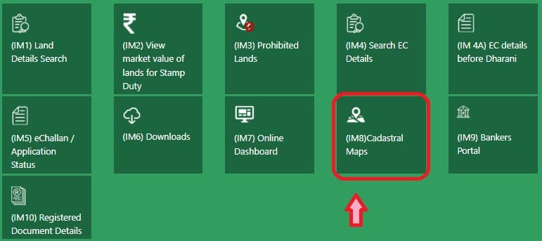
- Visit the TS Dharani Official Portal and click on Agriculture to continue.
- On the next page, you will see a list of services. Find the Cadastral Map option and click on it.
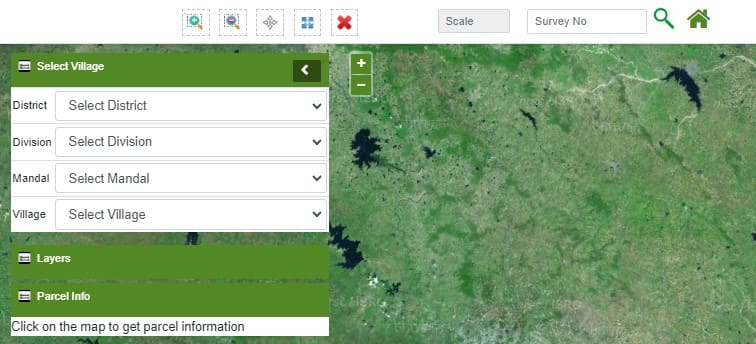
- Now you will see page like this, Select your district, mandal, division, and village.
- You will now see all available survey numbers in that village.
- To check a particular survey number, enter it in the top search box and click the search icon.
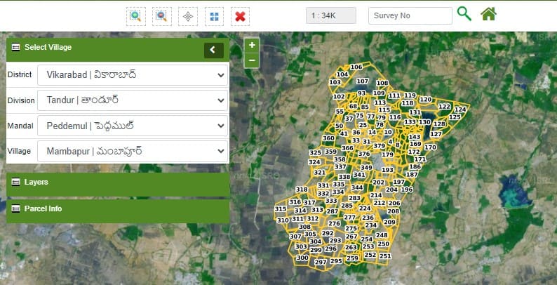
- Village maps with survey numbers are useful for seeing a complete village map with all available survey numbers, according to government records.
My village map with survey numbers of Telangana available for all Districts of Telangana. Any one can see village maps with survey numbers in telangana by following above process.
How to Download Cadastral Map with Survey Numbers?
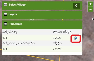
Once you have opened the village map with the survey number, click on the “Parcel Info” option on the left side of the screen, below the “Select Village” option. This will display the survey number, survey number land details, and a small download icon next to it. Click on the download icon to download the survey number details to your device.
Telangana land records with survey numbers map will available after downloading Cadastral Map with Survey Number in Dharani Portal.
With the Cadastral map available on the Dharani portal, you can view village maps, survey numbers, land records, and the precise location of survey numbers, including borders, sizes, and other details. These cadastral maps represent land records with village survey numbers initiated by the Telangana government under KCR’s leadership in 2020. The primary aim was to provide digital maps of villages and lands in Telangana
How do I find a location based on a survey number Telangana?
Visit the official Telangana Dharani website. Go to Cadastral Maps section. Then, pick the survey number you’re interested in by specifying the district, mandal, and village. This will show you the maps with your village’s survey numbers and location based survey numbers and other details.
How can I check my land zone in Telangana?
Open Village Map with survey numbers page, here Your village map will be displayed with the survey number of the individual plot of land that you entered. The land zone will be listed in the survey number details.